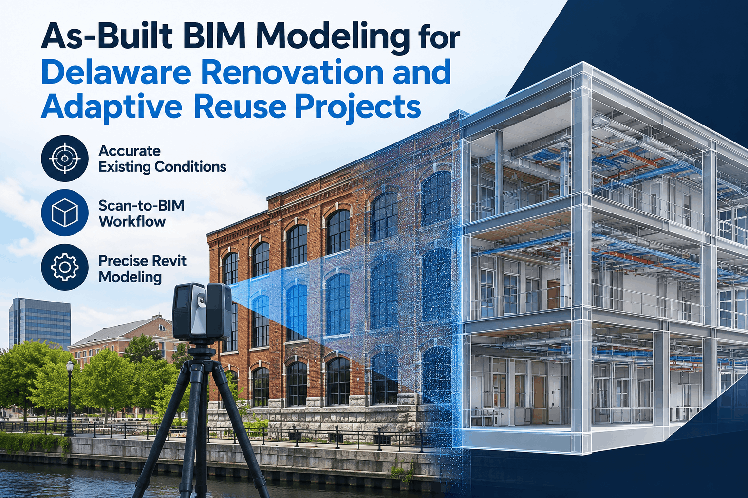
Renovating an existing structure across Delaware—whether it is transforming a historic textile mill in Wilmington into modern luxury apartments or retrofitting a commercial facility in Newark—presents a unique set of architectural and engineering hurdles. Outdated paper blueprints, undocumented field changes from past decades, and sagging structural elements often make traditional hand measurements unreliable.
When design professionals rely on imprecise dimensions, expensive field change orders and project delays inevitably follow. Utilizing As-Built Drafting Services Delaware powered by advanced as-built BIM modeling Delaware technologies completely eliminates this friction, replacing risky guesswork with millimetric precision.
By integrating 3D laser scanning and point cloud to Revit workflows, project teams capture true existing conditions before initial design begins. Consequently, architects, renovation general contractors, and historic preservation consultants can make data-driven decisions that safeguard budgets, protect historic character, and accelerate project timelines.
The Architectural Reality of Delaware’s Built Environment
Delaware features a rich architectural landscape spanning centuries. The First State houses thousands of commercial structures, industrial warehouses, and protected heritage assets. Converting these spaces through adaptive reuse requires far more care than ground-up construction.
1. Inaccurate Legacy Documentation
Legacy paper drawings rarely reflect reality. Over decades of operation, commercial buildings undergo unrecorded mechanical alterations, partition moves, and structural updates. If your team creates design deliverables based on legacy 2D drawings, field clashes during construction are virtually guaranteed. Professional As-Built Drafting Services Delaware eliminate these hidden surprises before construction crews ever arrive on-site.
2. Structural Settlement and Non-Orthogonal Geometry
Historic structures in Dover, Georgetown, or Old Wilmington rarely possess straight walls or 90-degree corners. Natural foundation settlement, timber warping, and aged masonry create non-standard geometries. Standard tape measurements simply cannot capture complex spatial curvature. High-definition 3D laser scanning captures millions of spatial data points, accurately capturing every out-of-plumb column and bowing floor slab.
3. Preserving Historic Integrity
Delaware’s historic preservation consultants face strict federal and state compliance mandates, such as the Secretary of the Interior’s Standards for Rehabilitation. When converting historic structures into commercial hubs, sensitive architectural details—such as cornices, ornate plasterwork, and legacy timber truss systems—must be meticulously documented before any demolition occurs. High-definition existing condition modeling creates an immutable digital twin, safeguarding historical integrity while permitting modern utility updates.
What is Scan-to-BIM and How Does it Work?
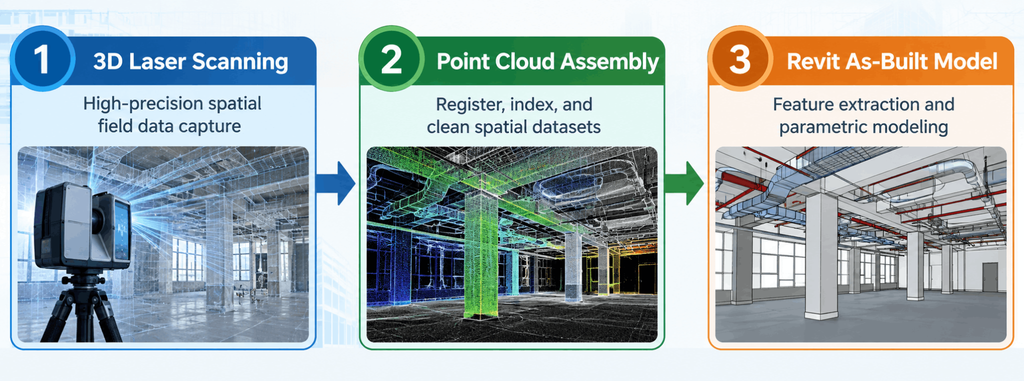
Converting physical structures into accurate digital models requires a highly structured technical pipeline. Scan-to-BIM services bridge the gap between physical reality and parametric digital design environments.
Step 1: High-Definition Field Scanning
Field technicians deploy terrestrial 3D laser scanners across the project perimeter and interior rooms. These devices project non-invasive LiDAR beams to record spatial positions with millimeter accuracy. The scanner captures millions of 3D data points per second, registering structural walls, ceiling spaces, visible utility runs, and MEP (Mechanical, Electrical, and Plumbing) distribution.
Step 2: Point Cloud Registration & Processing
Once scanning is complete, raw spatial files are imported into specialized processing software. The software stitches individual scan positions into a unified, geo-referenced 3D point cloud dataset. Unnecessary visual noise (such as moving site traffic or temporary debris) is cleaned and filtered out to ensure pristine analytical data.
Step 3: Parametric Revit As-Built Modeling
BIM specialists import the cleaned point cloud to Revit or similar parametric BIM authoring suites. Modeling technicians trace over the point cloud, extracting physical geometry to build intelligent 3D BIM elements—walls, slabs, structural beams, doors, windows, and MEP systems. The result is a fully functional Revit as-built modeling deliverable configured to your team’s specific Level of Development requirements (LOD 200–350).
Key Benefits of As-Built Drafting Services Delaware for Project Stakeholders
Integrating as-built BIM modeling Delaware into your project workflow provides tangible operational advantages across every phase of design and construction.
| Stakeholder Group | Primary Challenge Solved | Strategic As-Built BIM Advantage |
| Architectural Firms | Designing against inaccurate legacy blueprints | Provides an accurate parametric 3D canvas, eliminating field re-measurements and spatial redesigns. |
| Renovation GCs | Costly field clashes and change orders during trade installs | Facilitates early clash detection between new MEP distribution systems and existing structural constraints. |
| Historic Preservation Consultants | Strict regulatory mandates and preserving heritage details | Delivers sub-millimeter historical documentation for archival recording and restoration approval. |
Major Financial and Operational Advantages
- Up to 80% Reduction in Field Measuring Time: Eliminates manual tape measurements, laser distance meters, and manual sketches. A site that once took two weeks to survey can now be digitally captured in a fraction of the time.
- Near Elimination of Rework and Change Orders: Uncovers spatial conflicts in the design phase long before MEP contractors attempt to install ductwork or piping through unmapped structural beams.
- Accelerated Permitting and Design Approvals: Clear, highly detailed 3D spatial documentation provides Delaware building code authorities and historic boards with complete transparency, streamlining municipal approvals.
- Enhanced Safety in Risky Facilities: 3D laser scanners collect data remotely from ground level, eliminating the need for technicians to climb unstable scaffolding or enter hazardous confined spaces during preliminary surveys.
Defining Levels of Development (LOD 200–350) for Adaptive Reuse
Selecting the appropriate Level of Development (LOD) ensures your project receives the exact detail required without inflating modeling costs.
LOD 200: Conceptual Existing Conditions
- Scope: Ideal for preliminary feasibility studies and early spatial planning.
- Detail Level: Generic spatial masses representing overall building footprints, main structural walls, floor heights, and roof pitch without detailed component assemblies.
LOD 300: Precise Design and Drafting
- Scope: Standard benchmark for major renovation projects and architectural redesigns.
- Detail Level: Structural, architectural, and MEP elements are modeled with accurate dimensions, location coordinates, quantity metrics, and material properties.
LOD 350: Detailed Construction & Trade Coordination
- Scope: Essential for complex adaptive reuse conversions, dense MEP retrofits, and detailed trade coordination.
- Detail Level: Includes clear connection details, structural supports, main mounting brackets, pipe fittings, and accurate spatial clearance zones around critical machinery.
Real-World Applications Across Delaware Projects
Adaptive reuse and structural overhaul projects across Delaware highlight the immense value of digital existing condition workflows.
1. Wilmington Commercial-to-Residential Conversions
Converting office towers into modern apartment complexes requires inserting new plumbing risers, HVAC ducting, and electrical conduits through legacy floor plates. Comprehensive Revit as-built modeling highlights exact floor slab thicknesses, concrete beam locations, and existing vertical shafts. This allows MEP engineers to route new infrastructure without damaging structural components. Learn more about optimizing your mechanical systems with Acura BIM Coordination Services.
2. Historic Preservation in Dover & Old Wilmington
Preserving historic civic structures demands non-destructive surveying techniques. Terrestrial laser scanning allows historic preservation consultants to document crumbling exterior masonry, intricate woodwork, and custom molding without physical contact. The resulting digital twin acts as a permanent record for future maintenance or restoration efforts. Architectural firms can leverage specialized Acura BIM Point Cloud to BIM Modeling to convert complex point clouds into actionable parametric models.
3. Industrial Facility Retrofits in Newark & New Castle
Upgrading active manufacturing or industrial plants requires precise mapping of existing pipe bridges, structural steel frameworks, and industrial equipment. Using accurate Scan-to-BIM services guarantees that replacement machinery fits into existing bays with millimeter precision, avoiding expensive operational downtime. Explore our comprehensive architectural capabilities on our Acura BIM Services Overview Page.
To review standard BIM execution frameworks, inspect the official National Institute of Building Sciences BIM Guidelines.
How Acura BIM Delivers Superior As-Built Solutions
Executing accurate As-Built Drafting Services Delaware requires technical precision, specialized software, and deep regional expertise. Acura BIM provides complete end-to-end Scan-to-BIM services tailored to the needs of architects, general contractors, and preservation specialists.
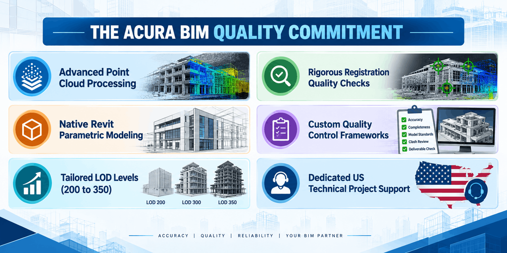
Why Leading Delaware Teams Partner with Acura BIM
- Uncompromised Dimensional Accuracy: Our specialized BIM team works strictly within tight tolerances, ensuring your existing condition modeling reflects true field conditions.
- Tailored Workflow Integration: We deliver natively formatted Autodesk Revit (.RVT), AutoCAD (.DWG), and IFC files that integrate seamlessly into your firm’s existing design software stack.
- Clash-Free Existing Condition Datasets: We audit point cloud data to eliminate spatial ambiguities, allowing your engineers to design around existing structural constraints with absolute confidence.
- Fast Project Turnarounds: Our optimized production pipelines mean you receive accurate, construction-ready parametric models quickly, keeping your project moving forward.
Transform Your Delaware Renovation Project Today
Do not allow inaccurate legacy drawings, hidden structural elements, or field misalignments to inflate your project budget and delay construction schedules. Partner with Acura BIM to access elite As-Built Drafting Services Delaware tailored specifically for your next renovation, retrofitting, or adaptive reuse project.
Whether you are restoring a protected historic site or coordinating a complex commercial overhaul, our team delivers the digital precision you need to build with complete confidence.
Contact Acura BIM Today to discuss your project requirements, request a custom project quote, or speak with a Scan-to-BIM specialist!
Frequently Asked Questions (FAQ)
What are As-Built Drafting Services Delaware, and why are they essential for renovations?
As-built drafting services create detailed digital drawings and 3D BIM models that reflect the exact physical state of an existing building. They are essential for renovation projects because legacy blueprints are frequently outdated or inaccurate. Creating precise as-built models upfront prevents costly design revisions and field change orders during construction.
What is the primary difference between traditional 2D as-built drafting and 3D Scan-to-BIM modeling?
Traditional 2D as-built drafting relies on manual tape or laser measurements to produce flat CAD lines, which often miss spatial irregularities or hidden mechanical routing. 3D Scan-to-BIM modeling utilizes high-definition laser scanners to generate a millimeter-accurate point cloud, which is then converted into an intelligent parametric Revit model containing complete spatial and material data.
How does point cloud to Revit modeling help historic preservation consultants?
Laser scanning is non-destructive, allowing field technicians to capture intricate architectural details, irregular structures, and bowing walls without contacting delicate historical materials. Converting the resulting point cloud to Revit provides historic preservation consultants with a accurate digital twin that complies with strict conservation and restoration standards.
What Level of Development (LOD) is recommended for commercial adaptive reuse projects?
Most commercial adaptive reuse projects require LOD 300 to LOD 350. LOD 300 provides accurate spatial dimensions, geometry, and locations for structural and architectural components, while LOD 350 adds critical connection details, main pipe fittings, and clear MEP support clearances necessary for clash-free trade coordination.
How quickly can a Scan-to-BIM project be completed in Delaware?
Project timelines vary based on square footage, architectural complexity, and required LOD levels. However, field laser scanning typically takes only 1 to 3 days for standard commercial facilities, while point-cloud-to-Revit conversion generally requires 5 to 10 business days for complete model delivery.